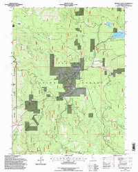
1994 Map of Meadow Valley
USGS Topo · Published 1998About this map
Spanish Ranch and Meadow Valley anchor this portion of the northern Sierra Nevada, where the legacy of gold mining and timber is etched into the landscape of the Plumas National Forest. The map documents a transition from industrial activity to forest management, noting the Pineleaf Mine (Site) and a Gravel Pit alongside a Forestry Camp and a prominent Water Tank.
Find a feature on this map
53 named features on this map. Tap any name to fly to it.
Don’t see what you’re looking for? This feature index may not catch every label — zoom into the map to look around manually.
Map Details
Editions of this 1994 Meadow Valley Map
This is the sole edition of this map. No revisions or reprints were ever made.
Other maps of this area

1886 · Honey Lake
USGS Topo · 1:250,000

1886 · Lassen Peak
USGS Topo · 1:250,000

1888 · Bidwell Bar
USGS Topo · 1:125,000

1891 · Bidwell Bar
USGS Topo · 1:125,000

1891 · Downieville
USGS Topo · 1:125,000

1891 · Honey Lake
USGS Topo · 1:250,000

1892 · Lassen Peak
USGS Topo · 1:250,000

1893 · Bidwell Bar
USGS Topo · 1:125,000

1893 · Honey Lake
USGS Topo · 1:250,000

1893 · Downieville
USGS Topo · 1:125,000