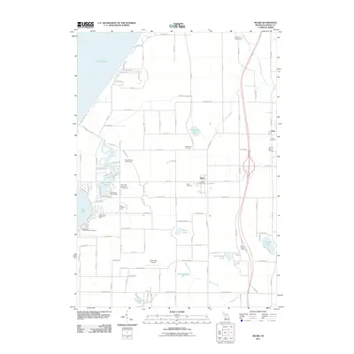
2011 Map of Mears
USGS Topo · Published 2011About this map
Mears and the western edge of Hart define the human landscape of this Oceana County survey. Situated near the eastern shoreline of Lake Michigan, the area is characterized by its transition from agricultural lands to the complex hydrologic network of Silver Lake and Upper Silver Lake. Local history is anchored by the Mears Post Office and several burial grounds, including Round Lake Cemetery and Mears Cemetery. The terrain is shaped by numerous waterways like Pentwater River, Bender Creek, and the Golden Drainage Ditch. Recreational infrastructure is prominent throughout, notably around the dunes and water, with features such as Silver Lake State Park Campground and Golden Sands Golf Course showing the region's importance as a seasonal destination. Transportation routes like Baseline Rd and the proximity of the Silver Lake Airport link these lakeside settlements to the inland county seat.
Find a feature on this map
70 named features on this map. Tap any name to fly to it.
Don’t see what you’re looking for? This feature index may not catch every label — zoom into the map to look around manually.
Map Details
Editions of this 2011 Mears Map
This is the sole edition of this map. No revisions or reprints were ever made.
Other maps of this area

1931 · Hart NW
USGS Topo · 1:31,680

1931 · Hart SE
USGS Topo · 1:31,680

1931 · Hart NE
USGS Topo · 1:31,680

1932 · Ludington SW
USGS Topo · 1:31,680

1932 · Ludington SE
USGS Topo · 1:31,680

1954 · Milwaukee
USGS Topo · 1:250,000

1958 · Milwaukee
USGS Topo · 1:250,000

1959 · Ludington
USGS Topo · 1:62,500

1959 · Hart
USGS Topo · 1:62,500
1976 · Hart NW
USGS Topo · 1:24,000