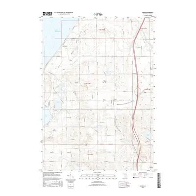
2017 Map of Mears
USGS Topo · Published 2017About this map
The dunes and orchards of Oceana County are defined here by the waters of Lake Michigan and the winding course of the Pentwater River. In the community of Mears, the landscape is shaped by the transition from agriculture to recreation, evidenced by the William Field Memorial Hart-Montague Trail State Park cutting through the center of town. Genealogists will find the Mears Cem, Round Lake Cem, and Hart Cem clearly marked across the township. Further west, the recreation hub around Upper Silver Lake and the Silver Lake Airport suggests a long-standing seasonal economy. The drainage patterns are managed through systems like the Golden Drainage Ditch, supporting the fruit-growing region between the larger settlements of Hart and Shelby.
Find a feature on this map
103 named features on this map. Tap any name to fly to it.
Don’t see what you’re looking for? This feature index may not catch every label — zoom into the map to look around manually.
Map Details
Editions of this 2017 Mears Map
This is the sole edition of this map. No revisions or reprints were ever made.
Other maps of this area

1931 · Hart NW
USGS Topo · 1:31,680

1931 · Hart SE
USGS Topo · 1:31,680

1931 · Hart NE
USGS Topo · 1:31,680

1932 · Ludington SW
USGS Topo · 1:31,680

1932 · Ludington SE
USGS Topo · 1:31,680

1954 · Milwaukee
USGS Topo · 1:250,000

1958 · Milwaukee
USGS Topo · 1:250,000

1959 · Ludington
USGS Topo · 1:62,500

1959 · Hart
USGS Topo · 1:62,500
1976 · Hart NW
USGS Topo · 1:24,000