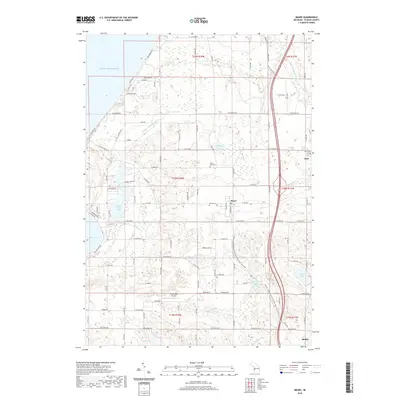
2019 Map of Mears
USGS Topo · Published 2019About this map
The eastern shore of Lake Michigan dominates the western edge of this 2019 survey, where the dunes meet a landscape of glacial lakes and small agricultural settlements. The village of Mears serves as a central hub, flanked by the township seats of Hart and Shelby to the east and south. A legacy of local heritage is preserved at Round Lake Cem, Mears Cem, and Hart Cem, while the modern recreational character of the county is evident in the William Field Memorial-Hart-Montague Trail State Park and the specialized Silver Lake Airport.
Find a feature on this map
65 named features on this map. Tap any name to fly to it.
Don’t see what you’re looking for? This feature index may not catch every label — zoom into the map to look around manually.
Map Details
Editions of this 2019 Mears Map
This is the sole edition of this map. No revisions or reprints were ever made.
Other maps of this area

1931 · Hart NW
USGS Topo · 1:31,680

1931 · Hart SE
USGS Topo · 1:31,680

1931 · Hart NE
USGS Topo · 1:31,680

1932 · Ludington SW
USGS Topo · 1:31,680

1932 · Ludington SE
USGS Topo · 1:31,680

1954 · Milwaukee
USGS Topo · 1:250,000

1958 · Milwaukee
USGS Topo · 1:250,000

1959 · Ludington
USGS Topo · 1:62,500

1959 · Hart
USGS Topo · 1:62,500
1976 · Hart NW
USGS Topo · 1:24,000