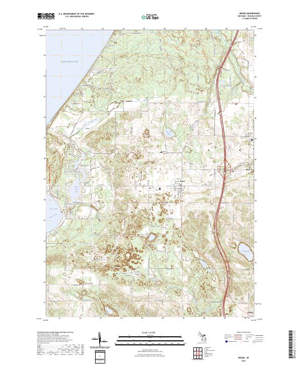
2023 Map of Mears
USGS Topo · Published 2023About this map
Lake Michigan defines the western edge of this coastal landscape, where the shifting sands meet a network of small lakes and agricultural drainages. The settlement of Mears serves as a central hub, flanked by the Silver Lake-Orv Area Trl and the extensive waters of Silver Lake and Upper Silver Lake. This modern geography is deeply connected to its past through several burial grounds, including Mears Cem, Round Lake Cem, and Hart Cem, which anchor the local genealogy of Oceana County.
Find a feature on this map
76 named features on this map. Tap any name to fly to it.
Don’t see what you’re looking for? This feature index may not catch every label — zoom into the map to look around manually.
Map Details
Editions of this 2023 Mears Map
This is the sole edition of this map. No revisions or reprints were ever made.
Other maps of this area

1931 · Hart NW
USGS Topo · 1:31,680

1931 · Hart SE
USGS Topo · 1:31,680

1931 · Hart NE
USGS Topo · 1:31,680

1932 · Ludington SW
USGS Topo · 1:31,680

1932 · Ludington SE
USGS Topo · 1:31,680

1954 · Milwaukee
USGS Topo · 1:250,000

1958 · Milwaukee
USGS Topo · 1:250,000

1959 · Ludington
USGS Topo · 1:62,500

1959 · Hart
USGS Topo · 1:62,500
1976 · Hart NW
USGS Topo · 1:24,000