2022 Map of Mecca
USGS Topo · Published 2022About this map
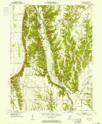
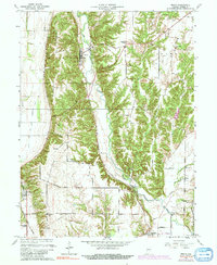
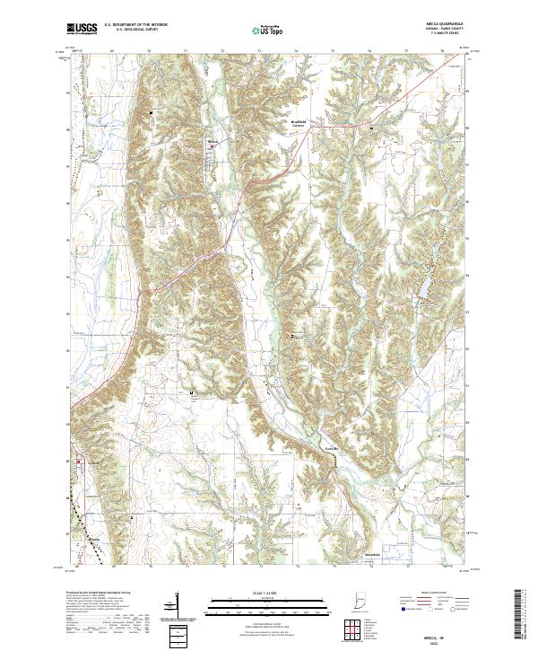
Big Raccoon Creek and its tributary Little Raccoon Creek carve a winding path through this corner of Parke County, defining the local geography around the town of Mecca. This 2022 survey illustrates a landscape of established small settlements and rural homesteads, including Bradfield Corner and Coxville. The region is marked by numerous family and community burial grounds such as Hixon Cem, Union Cem, and Orlea Cem, providing essential geographic markers for genealogical research. Along the western edge, the Wabash River and the Luford Dike and Levee Association Ditch highlight the ongoing management of the river's floodplain. Further south, the map details the layout of Lyford and Numa, as well as Rosedale situated near the intersection of Sulphur Br and the Cox Number One Ditch.
Find a feature on this map
68 named features on this map. Tap any name to fly to it.
Don’t see what you’re looking for? This feature index may not catch every label — zoom into the map to look around manually.
Map Details
Editions of this 2022 Mecca Map
This is the sole edition of this map. No revisions or reprints were ever made.