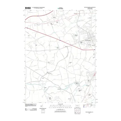
2010 Map of Mechanicsburg
USGS Topo · Published 2010About this map
Mechanicsburg serves as the central hub of this Cumberland County landscape, where the convergence of suburban expansion and agricultural history is clearly visible. The southern portion of the quadrangle is defined by the winding path of Yellow Breeches Creek, which passes by the community of Williams Grove and several older riverside settlements like Leidighs and Brandtsville. Genealogists and local historians will find significant value in the distribution of burial grounds across the area, including the War of 1812 Memorial Cemetery near Hogestown and the Bakers Church Cemetery near the village of Allen.
Find a feature on this map
101 named features on this map. Tap any name to fly to it.
Don’t see what you’re looking for? This feature index may not catch every label — zoom into the map to look around manually.
Map Details
Editions of this 2010 Mechanicsburg Map
This is the sole edition of this map. No revisions or reprints were ever made.
Other maps of this area

1892 · Harrisburg
USGS Topo · 1:62,500

1899 · Harrisburg
USGS Topo · 1:62,500

1904 · Carlisle
USGS Topo · 1:62,500

1906 · New Cumberland
USGS Topo · 1:62,500

1907 · New Bloomfield
USGS Topo · 1:62,500

1924 · Harrisburg
USGS Topo · 1:62,500

1943 · New Cumberland
USGS Topo · 1:62,500

1943 · Harrisburg
USGS Topo · 1:62,500

1943 · New Bloomfield
USGS Topo · 1:62,500

1943 · Carlisle
USGS Topo · 1:62,500
Featured Places
- Middlesex Township, PA
- New Kingstown, Silver Spring Township
- Carroll Manor, PA
- Churchtown, Monroe Township
- Liebys Trailer Park, Silver Spring Township