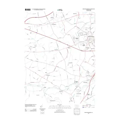
2013 Map of Mechanicsburg
USGS Topo · Published 2013About this map
The winding course of Yellow Breeches Creek defines the southern portion of this Cumberland County landscape, separating established hamlets like Leidighs and Brandtsville from the rising suburbs near Mechanicsburg. The region is a dense network of historically significant transportation corridors, where the Carlisle Pike and Harrisburg Pike cut across the northern terrain near New Kingstown and Hogestown. This 2013 survey illustrates the complex layering of old crossroads settlements such as Churchtown and Allen against modern residential expansions like White Rock Acres and Berkshire Hills. Notable industrial and infrastructure remnants are visible at Dillsburg Junction and the D and M Junction, marking the path of the rail lines that once fueled the local economy. From the high ground of Stony Ridge to the recreation areas at Mount Oliver Campgrounds near Williams Grove, the map provides a precise account of the modern Cumberland Valley interface.
Find a feature on this map
168 named features on this map. Tap any name to fly to it.
Don’t see what you’re looking for? This feature index may not catch every label — zoom into the map to look around manually.
Map Details
Editions of this 2013 Mechanicsburg Map
This is the sole edition of this map. No revisions or reprints were ever made.
Other maps of this area

1892 · Harrisburg
USGS Topo · 1:62,500

1899 · Harrisburg
USGS Topo · 1:62,500

1904 · Carlisle
USGS Topo · 1:62,500

1906 · New Cumberland
USGS Topo · 1:62,500

1907 · New Bloomfield
USGS Topo · 1:62,500

1924 · Harrisburg
USGS Topo · 1:62,500

1943 · New Cumberland
USGS Topo · 1:62,500

1943 · Harrisburg
USGS Topo · 1:62,500

1943 · New Bloomfield
USGS Topo · 1:62,500

1943 · Carlisle
USGS Topo · 1:62,500
Featured Places
- Middlesex Township, PA
- New Kingstown, Silver Spring Township
- Carroll Manor, PA
- Churchtown, Monroe Township
- Liebys Trailer Park, Silver Spring Township