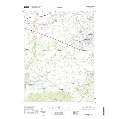
2019 Map of Mechanicsburg
USGS Topo · Published 2019About this map
Yellow Breeches Creek defines the southern reach of this landscape, winding past the settlements of Williams Grove, Brandtsville, and Rosegarden. The map details the developed corridor of Mechanicsburg, where the NSA Mechanicsburg installation sits alongside residential grids and the Norfolk Southern line. Numerous legacy sites provide significant local history and genealogical depth, including the Silver Spring Presbyterian Church Cem and the Old Graveyard in Allen. To the west, the Appalachian National Scenic Trail traverses the ridges near Neiderer Airport and Hickorytown. This modern survey documents the evolution of the Trindle Spring drainage and the surrounding suburban growth that has filled the gaps between historic hamlets like Locust Point and Roxbury at the edge of the Cumberland Co York Co border.
Find a feature on this map
234 named features on this map. Tap any name to fly to it.
Don’t see what you’re looking for? This feature index may not catch every label — zoom into the map to look around manually.
Map Details
Editions of this 2019 Mechanicsburg Map
This is the sole edition of this map. No revisions or reprints were ever made.
Other maps of this area

1892 · Harrisburg
USGS Topo · 1:62,500

1899 · Harrisburg
USGS Topo · 1:62,500

1904 · Carlisle
USGS Topo · 1:62,500

1906 · New Cumberland
USGS Topo · 1:62,500

1907 · New Bloomfield
USGS Topo · 1:62,500

1924 · Harrisburg
USGS Topo · 1:62,500

1943 · New Cumberland
USGS Topo · 1:62,500

1943 · Harrisburg
USGS Topo · 1:62,500

1943 · New Bloomfield
USGS Topo · 1:62,500

1943 · Carlisle
USGS Topo · 1:62,500
Featured Places
- Middlesex Township, PA
- New Kingstown, Silver Spring Township
- Carroll Manor, PA
- Churchtown, Monroe Township
- Liebys Trailer Park, Silver Spring Township