2023 Map of Mechanicsburg
USGS Topo · Published 2023About this map
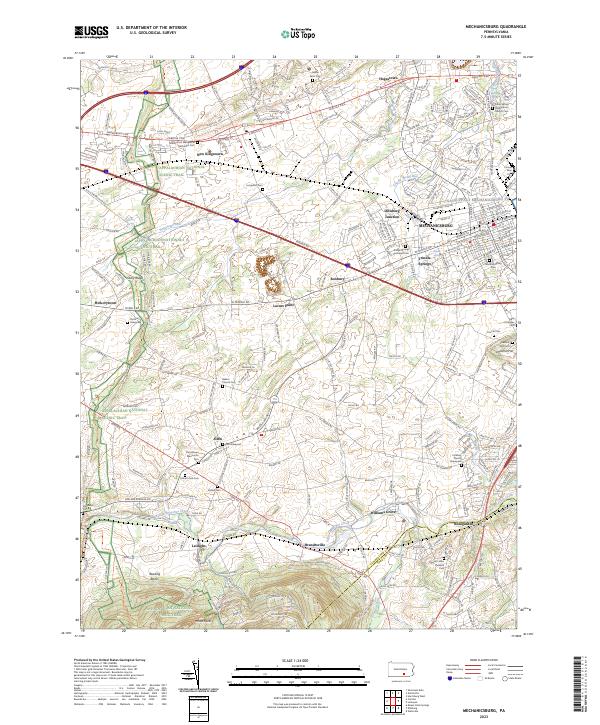
Mechanicsburg is the central hub of this Cumberland County survey, revealing a landscape where established borough streets meet sprawling agricultural tracts and historic religious sites. The map documents several significant faith-based landmarks, including the Silver Spring Presbyterian Church and Trindle Springs Lutheran Cem, alongside smaller family and community burial sites like the Strickler Graveyard and Cocklin Church Graveyard. The southwestern portion of the sheet is defined by the Appalachian National Scenic Trail as it traverses the ridge near Stony Ridge and White Rocks, overlooking the winding path of Yellow Breeches Creek. This waterway serves as a natural boundary near settlements like Brandtsville and Leidighs, where the terrain transitions from the higher elevations of the Reading Banks to the fertile valley floor. In the northeast, the Naval Support Activity Mechanicsburg marks a significant federal presence amidst the suburban expansion and older hamlets like New Kingstown.
Find a feature on this map
71 named features on this map. Tap any name to fly to it.
Don’t see what you’re looking for? This feature index may not catch every label — zoom into the map to look around manually.
Map Details
Editions of this 2023 Mechanicsburg Map
This is the sole edition of this map. No revisions or reprints were ever made.
Historical Maps of Upper Allen Township Through Time
3 maps found
Featured Locations
- Middlesex Township, PA
- Monroe Township, PA
- Silver Spring Township, PA
- Carroll Manor, PA
- New Kingstown, Silver Spring Township