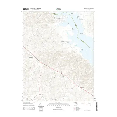
2014 Map of Mechanicsville
USGS Topo · Published 2014About this map
Mechanicsville and the surrounding rural communities of Saint Mary's County are documented here as they appeared in the early 21st century. The landscape is defined by the numerous inlets of the Patuxent River, including Washington Creek and Trent Hall Creek, which carve into the shoreline at Billiard Point and Trent Hall Point. A concentration of genealogical data is found in the many burial grounds throughout the area, such as All Faith Cem near Huntersville and the Saint Josephs Cem to the south. The small aviation facility at Sandy Point Airport sits near the shore, while further inland, the settlements of Oraville, Laurel Grove, and Oakville line the primary corridors moving through the peninsula's interior. The map also records the jurisdictional boundaries meeting in the water, where Saint Mary's County joins Charles and Calvert counties.
Find a feature on this map
44 named features on this map. Tap any name to fly to it.
Don’t see what you’re looking for? This feature index may not catch every label — zoom into the map to look around manually.
Map Details
Editions of this 2014 Mechanicsville Map
This is the sole edition of this map. No revisions or reprints were ever made.
Other maps of this area

1892 · Leonardtown
USGS Topo · 1:62,500

1892 · Prince Frederick
USGS Topo · 1:62,500

1892 · Brandywine
USGS Topo · 1:62,500

1894 · Wicomico
USGS Topo · 1:62,500

1895 · Prince Frederick
USGS Topo · 1:62,500

1895 · Wicomico
USGS Topo · 1:62,500

1895 · Brandywine
USGS Topo · 1:62,500

1895 · Leonardtown
USGS Topo · 1:62,500

1895 · Nomini
USGS Topo · 1:125,000

1898 · Nomini
USGS Topo · 1:125,000