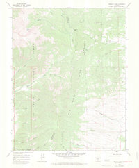
1967 Map of Medano Pass
USGS Topo · Published 1971About this map
Medano Pass serves as a critical divide in this high-altitude landscape, where the Rio Grande National Forest meets the San Isabel National Forest. The 1967 survey captures a geography defined by steep drainages and early industrial markings, including numerous prospects and the Ziegler Sawmill near the southern boundary. To the west, the topography shifts dramatically toward the Great Sand Dunes National Monument, where the eastern edges of the massive dune system are buffered by Little Medano Creek.
Find a feature on this map
28 named features on this map. Tap any name to fly to it.
Don’t see what you’re looking for? This feature index may not catch every label — zoom into the map to look around manually.
Map Details
Editions of this 1967 Medano Pass Map
4 editions found
Other maps of this area

1889 · Huerfano Park
USGS Topo · 1:125,000

1892 · Huerfano Park
USGS Topo · 1:125,000

1954 · Trinidad
USGS Topo · 1:250,000

1955 · Trinidad
USGS Topo · 1:250,000

1958 · Trinidad
USGS Topo · 1:250,000

1959 · Trinidad
USGS Topo · 1:250,000
1960 · Beck Mountain
USGS Topo · 1:24,000
1960 · Devils Gulch
USGS Topo · 1:24,000

1965 · Zapata Ranch
USGS Topo · 1:24,000

1967 · Mosca Pass
USGS Topo · 1:24,000