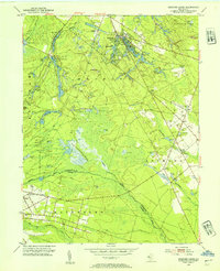
1953 Map of Medford Lakes
USGS Topo · Published 1954About this map
Medford Lakes and the surrounding Pine Barrens are defined by an intricate network of water and agriculture in this mid-century survey. The landscape is dominated by the cranberry industry, visible in the extensive West Jersey Cranberry Meadow and numerous Cranberry Bogs scattered across the Medford and Shamong townships. These commercial wetlands follow the natural drainage of the Atsion River and Mullica River, illustrating how local industry was tightly woven into the hydrologic pattern of southern New Jersey.
Find a feature on this map
43 named features on this map. Tap any name to fly to it.
Don’t see what you’re looking for? This feature index may not catch every label — zoom into the map to look around manually.
Map Details
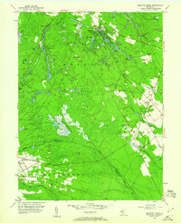
Editions of this 1953 Medford Lakes Map
2 editions found
Other maps of this area

1888 · Pemberton
USGS Topo · 1:62,500

1888 · Mount Holly
USGS Topo · 1:62,500

1890 · Hammonton
USGS Topo · 1:62,500

1890 · Mullica
USGS Topo · 1:62,500

1894 · Hammonton
USGS Topo · 1:62,500

1894 · Pemberton
USGS Topo · 1:62,500

1894 · Mount Holly
USGS Topo · 1:62,500

1894 · Mullica
USGS Topo · 1:62,500

1898 · Pemberton
USGS Topo · 1:62,500

1898 · Mount Holly
USGS Topo · 1:62,500
Featured Places
- Medford Township, NJ
- Southampton Township, NJ
- Tabernacle Township, NJ
- Waterford Township, NJ
- Shamong Township, NJ