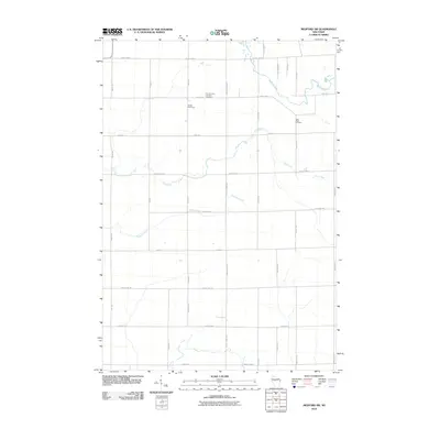
2010 Map of Medford SW
USGS Topo · Published 2010About this map
Black River meanders through the northeast corner of this Taylor County landscape, joined by the headwaters of Pine Creek and Trappers Creek as they drain a systematic grid of agricultural sections. The map reveals the cultural imprint of the community through its sacred spaces, notably the Amish Cemetery and Little Black Cemetery. Established road networks like County Hwy-D and County Hwy-A define the movement of goods and people across the township, while more localized landmarks like Our Saviours Lutheran Cemetery serve as focal points for local genealogy and history. The convergence of numerous named creeks and family-named roads illustrates a well-defined rural settlement pattern characteristic of this portion of Wisconsin.
Find a feature on this map
33 named features on this map. Tap any name to fly to it.
Don’t see what you’re looking for? This feature index may not catch every label — zoom into the map to look around manually.
Map Details
Editions of this 2010 Medford SW Map
This is the sole edition of this map. No revisions or reprints were ever made.
Other maps of this area

1951 · Lublin
USGS Topo · 1:48,000

1951 · Medford
USGS Topo · 1:48,000

1953 · Abbotsford
USGS Topo · 1:48,000

1953 · Owen
USGS Topo · 1:48,000

1953 · Eau Claire
USGS Topo · 1:250,000

1953 · Rice Lake
USGS Topo · 1:250,000

1958 · Eau Claire
USGS Topo · 1:250,000

1959 · Rice Lake
USGS Topo · 1:250,000

1963 · Abbotsford
USGS Topo · 1:62,500

1963 · Owen
USGS Topo · 1:62,500