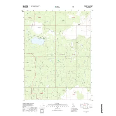
2018 Map of Medicine Lake
USGS Topo · Published 2018About this map
Medicine Lake and its surrounding volcanic landscape define this corner of Siskiyou County, where three national forests converge: Klamath National Forest, Modoc National Forest, and Shasta National Forest. The map documents a complex geological environment dominated by obsidian and lava, notably the Medicine Lake Glass Flow and the towering Glass Mtn. Settlement is minimal, focused on seasonal use at Telephone Flat and Bruin Flat, while the recreation-focused Medicine Lakeshore Trail and Little Medicine Lake Trail circle the central water bodies.
Find a feature on this map
35 named features on this map. Tap any name to fly to it.
Don’t see what you’re looking for? This feature index may not catch every label — zoom into the map to look around manually.
Map Details
Editions of this 2018 Medicine Lake Map
This is the sole edition of this map. No revisions or reprints were ever made.
Other maps of this area

1886 · Modoc Lava Bed
USGS Topo · 1:250,000

1892 · Modoc Lava-Bed
USGS Topo · 1:250,000

1932 · Bartle
USGS Topo · 1:96,000

1939 · Bartle
USGS Topo · 1:125,000

1952 · Timber Mountain
USGS Topo · 1:62,500

1952 · Medicine Lake
USGS Topo · 1:62,500

1954 · Alturas
USGS Topo · 1:250,000

1958 · Alturas
USGS Topo · 1:250,000

1961 · Hambone
USGS Topo · 1:62,500

1962 · Alturas
USGS Topo · 1:250,000