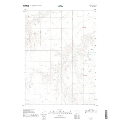
2017 Map of Meek NE
USGS Topo · Published 2017About this map
Scottville Cem sits on a plateau overlooking a landscape deeply incised by the drainage basins of north-central Nebraska. This area of Holt County is defined by the winding paths of Eagle Creek, Redbird Cr, and Blackbird Cr, which have carved intricate coulees into the plains. The distribution of water is further marked by several man-made impoundments, including the Pinkerman Reservoir Number 1, Pinkerman Reservoir Number 2, Asimus Reservoir, and Young Reservoir, indicating a reliance on managed water resources for ranching or local agriculture. The township and range lines of t32n r11w and t31n r10w structure the territory, with a systematic grid of section roads like 891 RD and 884 RD providing the only clear geometry across the winding creek beds and shifting elevation of Spring Cr.
Find a feature on this map
21 named features on this map. Tap any name to fly to it.
Don’t see what you’re looking for? This feature index may not catch every label — zoom into the map to look around manually.
Map Details
Editions of this 2017 Meek NE Map
This is the sole edition of this map. No revisions or reprints were ever made.
Other maps of this area

1950 · Dorsey NW
USGS Topo · 1:24,000

1950 · Lynch
USGS Topo · 1:24,000

1951 · Bristow
USGS Topo · 1:24,000

1952 · Spencer South
USGS Topo · 1:24,000

1954 · Dorsey SW
USGS Topo · 1:24,000

1954 · Meek NE
USGS Topo · 1:24,000

1954 · Opportunity
USGS Topo · 1:24,000

1954 · Meek SW
USGS Topo · 1:24,000

1954 · Meek
USGS Topo · 1:24,000

1955 · O'Neill
USGS Topo · 1:250,000