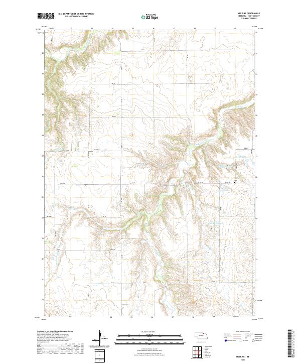
2021 Map of Meek NE
USGS Topo · Published 2021About this map
Scottville sits in the northeastern reaches of Holt County, defined by a landscape of intricate drainage networks and private water management. This 2021 survey highlights a rural environment where agriculture and water access are central, evidenced by named features like Pinkerman Reservoir Number 1 and Pinkerman Reservoir Number 2. The terrain is carved by numerous waterways including Redbird Cr, Eagle Creek, and Blackbird Cr, which have dictated the placement of local roads and property boundaries. Genealogists and local historians can find the Scottville Cem near the intersection of Oil Co Rd and 887th Rd, a primary landmark for the small community. Other private holdings like Asimus Reservoir and Young Reservoir further illustrate the reliance on managed water sources in this part of the Nebraska plains.
Find a feature on this map
25 named features on this map. Tap any name to fly to it.
Don’t see what you’re looking for? This feature index may not catch every label — zoom into the map to look around manually.
Map Details
Editions of this 2021 Meek NE Map
This is the sole edition of this map. No revisions or reprints were ever made.
Other maps of this area

1950 · Dorsey NW
USGS Topo · 1:24,000

1950 · Lynch
USGS Topo · 1:24,000

1951 · Bristow
USGS Topo · 1:24,000

1952 · Spencer South
USGS Topo · 1:24,000

1954 · Dorsey SW
USGS Topo · 1:24,000

1954 · Meek NE
USGS Topo · 1:24,000

1954 · Opportunity
USGS Topo · 1:24,000

1954 · Meek SW
USGS Topo · 1:24,000

1954 · Meek
USGS Topo · 1:24,000

1955 · O'Neill
USGS Topo · 1:250,000