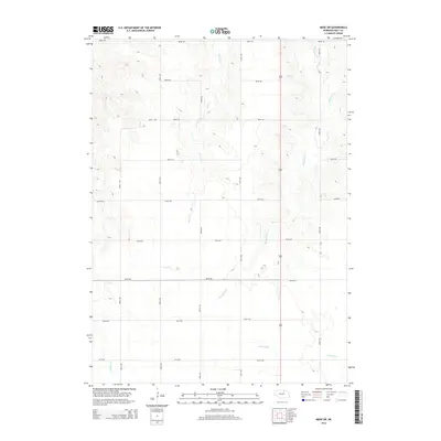
2014 Map of Meek SW
USGS Topo · Published 2014About this map
Honey Creek, Blackbird Creek, and Redbird Creek dominate this 2014 drainage profile of northern Nebraska, illustrating the intricate hydrology of the Holt County landscape. The map reveals a strictly regulated section-line grid of rural roads, including 883rd Rd and 490th Ave, which partition the terrain into a predictable agricultural layout. The elevation contours provided by the U.S. Geological Survey indicate a subtly undulating surface where small tributaries like E Br Eagle Creek have carved shallow valleys through the plains. This specific cartographic record highlights the intersection of modern road infrastructure with the natural meandering paths of local waterways, reflecting a region defined by extensive ranching and farming operations that rely on the seasonal flows of these creek systems.
Find a feature on this map
18 named features on this map. Tap any name to fly to it.
Don’t see what you’re looking for? This feature index may not catch every label — zoom into the map to look around manually.
Map Details
Editions of this 2014 Meek SW Map
This is the sole edition of this map. No revisions or reprints were ever made.
Other maps of this area

1954 · Atkinson SE
USGS Topo · 1:24,000

1954 · Meek NE
USGS Topo · 1:24,000

1954 · Opportunity
USGS Topo · 1:24,000

1954 · Meek SW
USGS Topo · 1:24,000

1954 · Meek
USGS Topo · 1:24,000

1954 · Atkinson NE
USGS Topo · 1:24,000

1955 · O'Neill
USGS Topo · 1:250,000

1958 · O'Neill
USGS Topo · 1:24,000

1958 · Inman
USGS Topo · 1:24,000

1959 · O'Neill
USGS Topo · 1:250,000