
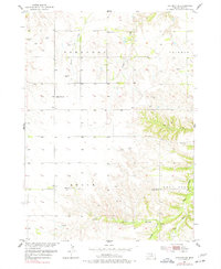
1954 Map of Atkinson NE
USGS Topo · Published 1956About this map
The northern Nebraska prairie of Holt County is documented here during the mid-1950s, a period of established rural townships including Saratoga, Coleman, Belle, and Rock Falls. The landscape is defined by the headwaters and branches of numerous watercourses, most notably Eagle Creek and its southern tributaries like North Branch and Middle Branch. This agricultural and ranching terrain is dotted with several district schools, including School No 187 and School No 147, reflecting the decentralized education system typical of the era. The small settlement of Saratoga and the Phoenix Cem serve as focal points for local family history research. This survey was conducted as part of the Department of the Interior's efforts for the development of the Missouri River Basin, capturing the region's topographical transition from flat tablelands to the dissected breaks near the creek valleys.
Find a feature on this map
20 named features on this map. Tap any name to fly to it.
Don’t see what you’re looking for? This feature index may not catch every label — zoom into the map to look around manually.
Map Details
Editions of this 1954 Atkinson NE Map
2 editions found
Other maps of this area

1951 · Butte SW
USGS Topo · 1:24,000

1952 · Spencer South
USGS Topo · 1:24,000

1952 · Butte SE
USGS Topo · 1:24,000

1954 · Atkinson SE
USGS Topo · 1:24,000

1954 · Atkinson
USGS Topo · 1:24,000

1954 · Meek SW
USGS Topo · 1:24,000

1954 · Meek
USGS Topo · 1:24,000

1954 · Atkinson NW
USGS Topo · 1:24,000

1955 · O'Neill
USGS Topo · 1:250,000

1959 · O'Neill
USGS Topo · 1:250,000