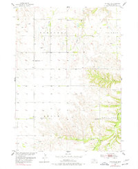
1954 Map of Atkinson NE
USGS Topo · Published 1977About this map
Saratoga and Rock Falls anchor this mid-century portrait of northeastern Holt County, revealing a landscape defined by small-scale township divisions and a network of rural education. The township of Belle and neighboring Coleman show a pattern of settlement organized around local schools, including School No 53 and School No 147, which served as vital community hubs before district consolidations. The terrain is marked by numerous windmills, essential for drawing water from the Sandhills-adjacent soil to support livestock.
Find a feature on this map
20 named features on this map. Tap any name to fly to it.
Don’t see what you’re looking for? This feature index may not catch every label — zoom into the map to look around manually.
Map Details
Editions of this 1954 Atkinson NE Map
2 editions found
Other maps of this area

1951 · Butte SW
USGS Topo · 1:24,000

1952 · Spencer South
USGS Topo · 1:24,000

1952 · Butte SE
USGS Topo · 1:24,000

1954 · Atkinson SE
USGS Topo · 1:24,000

1954 · Atkinson
USGS Topo · 1:24,000

1954 · Meek SW
USGS Topo · 1:24,000

1954 · Meek
USGS Topo · 1:24,000

1954 · Atkinson NW
USGS Topo · 1:24,000

1954 · Atkinson NE
USGS Topo · 1:24,000

1955 · O'Neill
USGS Topo · 1:250,000