
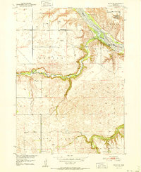
1951 Map of Butte SW
USGS Topo · Published 1951About this map
The Niobrara River carves a deep valley across this portion of northern Nebraska, serving as the natural boundary between Boyd and Holt counties. This 1951 survey documents a rural landscape shaped by the river’s drainage, where Big Sandy Creek and Little Sandy Cr meet the larger waterway amidst the rugged Mc Cully terrain. The distribution of educational and social landmarks reveals the decentralized nature of the community, with scattered rural schoolhouses such as Prairie Rose Sch, School No 20, and McKathnie Sch serving the local families. The presence of the Adams Cem and the Badger Sch (Abandoned) provides specific points of interest for genealogists tracing ancestral homesteads. Near the river, the Hull Lake Recreation Grounds and a Boy Scout Cabin indicate the area's role as a regional destination for outdoor activity in the mid-20th century.
Find a feature on this map
17 named features on this map. Tap any name to fly to it.
Don’t see what you’re looking for? This feature index may not catch every label — zoom into the map to look around manually.
Map Details
Editions of this 1951 Butte SW Map
2 editions found
Other maps of this area

1951 · Butte NW
USGS Topo · 1:24,000

1951 · Naper
USGS Topo · 1:24,000

1951 · Dustin
USGS Topo · 1:24,000

1952 · Butte SE
USGS Topo · 1:24,000

1954 · Atkinson NW
USGS Topo · 1:24,000

1954 · Atkinson NE
USGS Topo · 1:24,000

1954 · Stuart NE
USGS Topo · 1:24,000

1955 · O'Neill
USGS Topo · 1:250,000

1959 · O'Neill
USGS Topo · 1:250,000

1964 · Butte
USGS Topo · 1:24,000