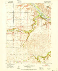
1951 Map of Butte SW
USGS Topo · Published 1951About this map
The Niobrara River defines the northern edge of this Nebraska landscape, where the border between Boyd and Holt counties meets at the water's edge. A network of rural education is visible across the townships of Dustin and Saratoga, including School No 20, Prairie Rose Sch, and McKathnie Sch. The map records a shift in the local infrastructure, noting the Badger Sch (Abandoned) near the river bluffs of Mc Cully.
Find a feature on this map
20 named features on this map. Tap any name to fly to it.
Don’t see what you’re looking for? This feature index may not catch every label — zoom into the map to look around manually.
Map Details
Editions of this 1951 Butte SW Map
2 editions found
Other maps of this area

1951 · Butte NW
USGS Topo · 1:24,000

1951 · Naper
USGS Topo · 1:24,000

1951 · Butte SW
USGS Topo · 1:24,000

1951 · Dustin
USGS Topo · 1:24,000

1952 · Butte SE
USGS Topo · 1:24,000

1954 · Atkinson NW
USGS Topo · 1:24,000

1954 · Atkinson NE
USGS Topo · 1:24,000

1954 · Stuart NE
USGS Topo · 1:24,000

1955 · O'Neill
USGS Topo · 1:250,000

1959 · O'Neill
USGS Topo · 1:250,000