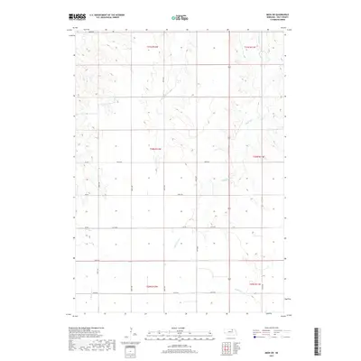
2017 Map of Meek SW
USGS Topo · Published 2017About this map
Blackbird Cr and its tributaries carve a network of drainages across this section of Holt County, defining a landscape of rolling terrain and agricultural plateaus. The passage of Highway 281 serves as the primary north-south artery, connecting the section lines and rural homesteads that characterize the local infrastructure. The drainage systems of Honey Cr and Redbird Cr intersect the township boundaries, revealing the natural hydrology that has influenced land use since the earliest settlements. A sparse but organized network of roads, including the descriptively named Oil Rd and several numbered avenues, provides access to the interior sections. This map documents the precise alignment of range and township lines, such as t30n r12w, illustrating the enduring influence of the Public Land Survey System on the modern Nebraska landscape.
Find a feature on this map
24 named features on this map. Tap any name to fly to it.
Don’t see what you’re looking for? This feature index may not catch every label — zoom into the map to look around manually.
Map Details
Editions of this 2017 Meek SW Map
This is the sole edition of this map. No revisions or reprints were ever made.
Other maps of this area

1954 · Atkinson SE
USGS Topo · 1:24,000

1954 · Meek NE
USGS Topo · 1:24,000

1954 · Opportunity
USGS Topo · 1:24,000

1954 · Meek SW
USGS Topo · 1:24,000

1954 · Meek
USGS Topo · 1:24,000

1954 · Atkinson NE
USGS Topo · 1:24,000

1955 · O'Neill
USGS Topo · 1:250,000

1958 · O'Neill
USGS Topo · 1:24,000

1958 · Inman
USGS Topo · 1:24,000

1959 · O'Neill
USGS Topo · 1:250,000