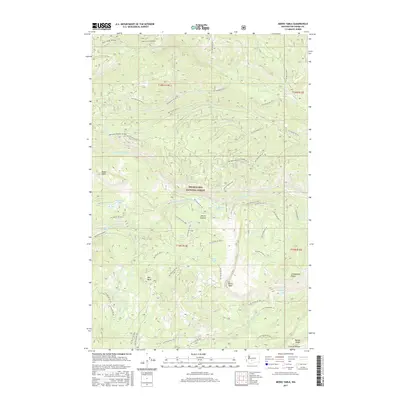
2017 Map of Meeks Table
USGS Topo · Published 2017About this map
The high plateau of Meeks Table and the distinct volcanic landforms of the Snoqualmie National Forest dominate this 2017 survey of Yakima County. This area is defined by sharp elevation changes, where features like Devils Table and Red Rock rise above a complex network of forest development roads and 4WD trails, such as 4WD Clover Springs. The drainage patterns are clearly marked by Nile Cr, Rattlesnake Creek, and several smaller alpine bodies including Angel Lake and McDaniel Lake. The presence of named landmarks like Cowpuncher Ridge and Grouse Heaven reflects the region's long history of ranching and hunting. The map provides a detailed view of the infrastructure within the national forest, including the numerous National Forest Development Roads that provide access through Devils Canyon and along the flanks of Bethel Ridge.
Find a feature on this map
59 named features on this map. Tap any name to fly to it.
Don’t see what you’re looking for? This feature index may not catch every label — zoom into the map to look around manually.
Map Details
Editions of this 2017 Meeks Table Map
This is the sole edition of this map. No revisions or reprints were ever made.
Other maps of this area

1899 · Ellensburg
USGS Topo · 1:125,000

1901 · Ellensburg
USGS Topo · 1:125,000

1902 · Mount Aix
USGS Topo · 1:125,000

1904 · Mt Aix
USGS Topo · 1:125,000

1950 · Yakima
USGS Topo · 1:250,000

1958 · Yakima
USGS Topo · 1:250,000

1961 · Yakima
USGS Topo · 1:250,000

1967 · Rimrock Lake
USGS Topo · 1:24,000

1967 · Tieton Basin
USGS Topo · 1:24,000

1971 · Nile
USGS Topo · 1:24,000