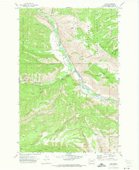
1971 Map of Nile
USGS Topo · Published 1973About this map
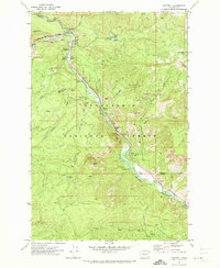
The Naches River corridor defines this portion of Yakima County, where the settlement of Nile sits along the winding Nile Road. At this time in the early 1970s, the valley floor is a mixture of small clearings and infrastructure, including the Nile Community Ch and the Rattlesnake Ranger Station. To the west, the landscape rises sharply into the Snoqualmie National Forest, marked by the distinct Cowpuncher Ridge and the Hanging Tree Campground along Rattlesnake Creek.
Find a feature on this map
51 named features on this map. Tap any name to fly to it.
Don’t see what you’re looking for? This feature index may not catch every label — zoom into the map to look around manually.
Map Details
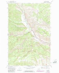
Editions of this 1971 Nile Map
2 editions found
Other maps of this area

1899 · Ellensburg
USGS Topo · 1:125,000

1901 · Ellensburg
USGS Topo · 1:125,000

1902 · Mount Aix
USGS Topo · 1:125,000

1904 · Mt Aix
USGS Topo · 1:125,000

1950 · Yakima
USGS Topo · 1:250,000

1958 · Yakima
USGS Topo · 1:250,000

1961 · Yakima
USGS Topo · 1:250,000
1967 · Tieton Basin
USGS Topo · 1:24,000
1971 · Milk Canyon
USGS Topo · 1:24,000
1971 · Cliffdell
USGS Topo · 1:24,000