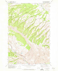
1971 Map of Milk Canyon
USGS Topo · Published 1973About this map
Cleman Mountain dominates the center of this landscape, its steep, canyon-scored slopes rising above the Wenas Valley to the north and the Naches River to the south. The map documents a rugged rangeland punctuated by a network of Jeep Trails and seasonal water sources like Mud Lake and numerous springs. Along the northern edge, the Wenas (Site) marks a point of historic settlement near the South Fork Wenas Creek, while the southern corridor follows the river's path through Horseshoe Bend. High-elevation landmarks such as the Lookout Tower and Radio Tower sit atop the ridges, overlooking a complex system of drainage features including Watering Trough Canyon and Woodcamp Canyon. The map provides a clear picture of land use in the early 1970s, from the grazing grounds of Sanford Pasture to industrial points like the Gravel Pit and various prospects.
Find a feature on this map
37 named features on this map. Tap any name to fly to it.
Don’t see what you’re looking for? This feature index may not catch every label — zoom into the map to look around manually.
Map Details
Editions of this 1971 Milk Canyon Map
2 editions found
Other maps of this area

1899 · Ellensburg
USGS Topo · 1:125,000

1901 · Ellensburg
USGS Topo · 1:125,000

1950 · Yakima
USGS Topo · 1:250,000

1958 · Ellensburg
USGS Topo · 1:62,500

1958 · Naches
USGS Topo · 1:24,000

1958 · Yakima
USGS Topo · 1:250,000

1961 · Yakima
USGS Topo · 1:250,000

1971 · Nile
USGS Topo · 1:24,000
1971 · Hudson Creek
USGS Topo · 1:24,000
1971 · Manastash Lake
USGS Topo · 1:24,000