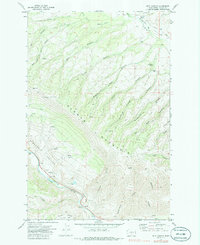
1971 Map of Milk Canyon
USGS Topo · Published 1986About this map
Cleman Mountain dominates this portion of Yakima County, rising sharply between the Wenas Valley to the northeast and the Naches River corridor to the southwest. The 1970s landscape is defined by its water-carved geography, featuring numerous canyons such as Milk Canyon, Evans Canyon, and Woodcamp Canyon that drain into the surrounding lowlands. A small Picnic Area and a Water Tank along the river suggest the recreational and logistical utility of the valley floor during this era.
Find a feature on this map
38 named features on this map. Tap any name to fly to it.
Don’t see what you’re looking for? This feature index may not catch every label — zoom into the map to look around manually.
Map Details
Editions of this 1971 Milk Canyon Map
2 editions found
Other maps of this area

1899 · Ellensburg
USGS Topo · 1:125,000

1901 · Ellensburg
USGS Topo · 1:125,000

1950 · Yakima
USGS Topo · 1:250,000

1958 · Ellensburg
USGS Topo · 1:62,500

1958 · Naches
USGS Topo · 1:24,000

1958 · Yakima
USGS Topo · 1:250,000

1961 · Yakima
USGS Topo · 1:250,000

1971 · Nile
USGS Topo · 1:24,000
1971 · Milk Canyon
USGS Topo · 1:24,000
1971 · Hudson Creek
USGS Topo · 1:24,000