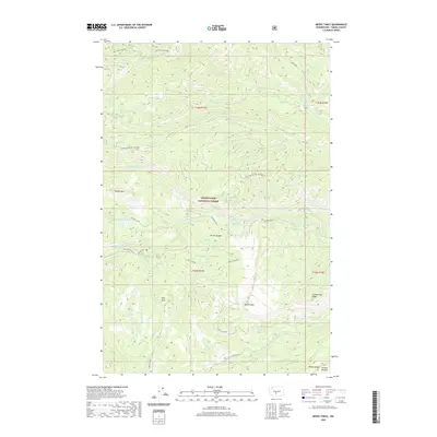
2020 Map of Meeks Table
USGS Topo · Published 2020About this map
Snoqualmie National Forest dominates this section of Yakima County, where the high-altitude terrain is defined by prominent plateaus and deep drainage systems. The namesake Meeks Table and nearby Devils Table stand as distinct geographic landmarks, while Bethel Ridge provides a significant spine across the landscape. The hydrography of the region is characterized by small, isolated mountain waters such as McDaniel Lake, Angel Lake, and Mal Lake, which feed into the complex network of Rattlesnake Creek and its many tributaries. This 2020 survey illustrates the modern management of these timberlands, showing a web of access routes including 4WD Clover Springs and the Little Rattlesnake track. From the heights of Cowpuncher Ridge to the depths of Devils Canyon, the map traces the intersection of natural hydrology and recreational or forest-service infrastructure in the central Cascades.
Find a feature on this map
36 named features on this map. Tap any name to fly to it.
Don’t see what you’re looking for? This feature index may not catch every label — zoom into the map to look around manually.
Map Details
Editions of this 2020 Meeks Table Map
This is the sole edition of this map. No revisions or reprints were ever made.
Other maps of this area

1899 · Ellensburg
USGS Topo · 1:125,000

1901 · Ellensburg
USGS Topo · 1:125,000

1902 · Mount Aix
USGS Topo · 1:125,000

1904 · Mt Aix
USGS Topo · 1:125,000

1950 · Yakima
USGS Topo · 1:250,000

1958 · Yakima
USGS Topo · 1:250,000

1961 · Yakima
USGS Topo · 1:250,000

1967 · Rimrock Lake
USGS Topo · 1:24,000

1967 · Tieton Basin
USGS Topo · 1:24,000

1971 · Nile
USGS Topo · 1:24,000