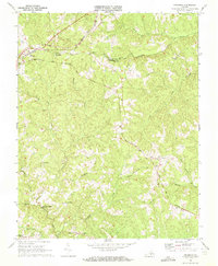
1968 Map of Meherrin
USGS Topo · Published 1972About this map
The boundary between Prince Edward Co and Lunenburg Co is defined by the winding course of the North Fork Nottoway River and local rail lines. This late 1960s landscape is anchored by the settlement of Meherrin, situated at the convergence of the Southern and Norfolk and Western railroads. These transit corridors dictated the development of the region, connecting smaller hubs like Scholfield and Nuthush to larger markets.
Find a feature on this map
30 named features on this map. Tap any name to fly to it.
Don’t see what you’re looking for? This feature index may not catch every label — zoom into the map to look around manually.
Map Details
Editions of this 1968 Meherrin Map
2 editions found
Other maps of this area

1891 · Farmville
USGS Topo · 1:125,000

1893 · Farmville
USGS Topo · 1:125,000

1947 · Roanoke
USGS Topo · 1:250,000

1953 · Greensboro
USGS Topo · 1:250,000

1954 · Greensboro
USGS Topo · 1:250,000

1955 · Chase City
USGS Topo · 1:62,500

1955 · Kenbridge
USGS Topo · 1:62,500

1958 · Crewe
USGS Topo · 1:62,500

1958 · Keysville
USGS Topo · 1:62,500

1959 · Roanoke
USGS Topo · 1:250,000