
1951 Map of Melbourne East
USGS Topo · Published 1951About this map
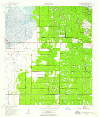
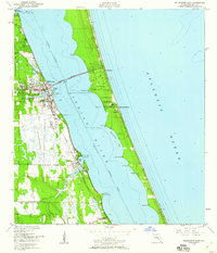
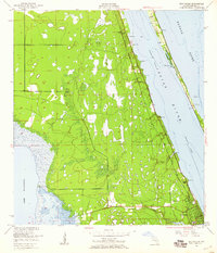
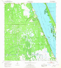
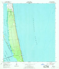
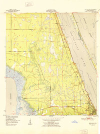
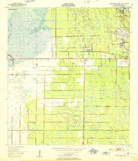
The Indian River and the Intracoastal Waterway define this coastal landscape, separating the mainland settlements from the barrier island communities. Melbourne serves as a central hub, connected to the island by the Melbourne Causeway, which leads directly into Indialantic. To the north, the town of Eau Gallie sits along the shoreline, while Palm Bay and Malabar stretch southward along the mainland coast. The transit infrastructure of the era is anchored by the Florida East Coast railroad and highway, which parallel the water and support the growth of these riverside communities.
Find a feature on this map
33 named features on this map. Tap any name to fly to it.
Don’t see what you’re looking for? This feature index may not catch every label — zoom into the map to look around manually.
Map Details
Editions of this 1951 Melbourne East Map
This is the sole edition of this map. No revisions or reprints were ever made.
Other maps of this area
1949 · Melbourne West
USGS Topo · 1:24,000
1949 · Melbourne East
USGS Topo · 1:24,000
1949 · Sebastian NW
USGS Topo · 1:24,000
1949 · Eau Gallie
USGS Topo · 1:24,000
1949 · Grant
USGS Topo · 1:24,000
1949 · Tropic
USGS Topo · 1:24,000
1951 · Sebastian NW
USGS Topo · 1:24,000
1951 · Eau Gallie
USGS Topo · 1:24,000
1951 · Melbourne West
USGS Topo · 1:24,000

1951 · Grant
USGS Topo · 1:24,000