2024 Map of Mellwood
USGS Topo · Published 2024About this map
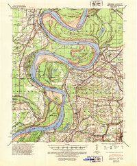
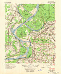
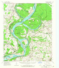
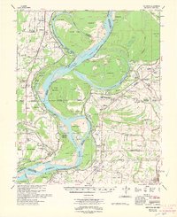
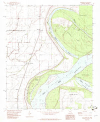
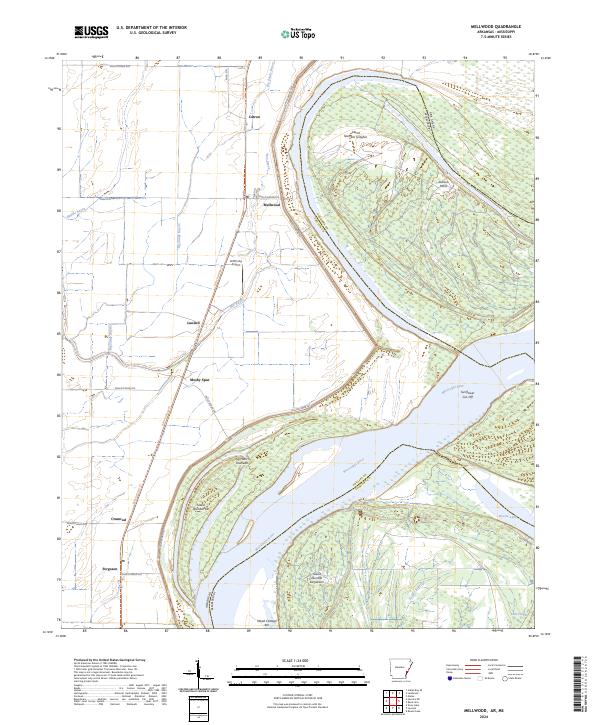
The Mississippi River defines the landscape of this Arkansas-Mississippi border region, creating a complex network of chutes and islands such as Island Number Sixtyfive and Jug Harris Towhead. The western bank in Phillips County is home to a string of small settlements including Mellwood, Lundell, and Ferguson, which are connected by a grid of rural routes like Phillips Road 533. The presence of Mosby Spur and the Delta Heritage Trl suggests a historical reliance on rail infrastructure that has since transitioned to recreational use.
Find a feature on this map
39 named features on this map. Tap any name to fly to it.
Don’t see what you’re looking for? This feature index may not catch every label — zoom into the map to look around manually.
Map Details
Editions of this 2024 Mellwood Map
This is the sole edition of this map. No revisions or reprints were ever made.
Historical Maps of Offutt Landing Through Time
7 maps found