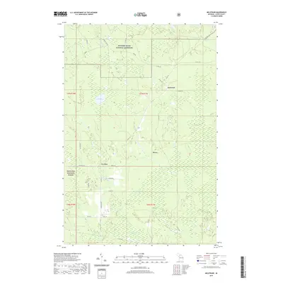
2019 Map of Melstrand
USGS Topo · Published 2019About this map
Pictured Rocks National Lakeshore and Hiawatha National Forest dominate this Upper Peninsula landscape, where the northern wetlands and inland waters define the local geography. The small settlements of Melstrand, Van Meer, and Myren serve as the primary hubs connected by a network of backroads like Adams Trl and Cusino Rd. The terrain is characterized by a high density of water features, from the large expanse of Creighton Marsh in the south to Noble Lake and Humphrey Pond near the center. Waterways such as the Mosquito River, Chapel Creek, and Beaver Cr traverse the timbered land, illustrating the transition between the protected lakeshore and the managed forest. This mapping of Alger County demonstrates the persistent rural character of the region, where logging roads and natural drainage systems remain more prominent than urban development.
Find a feature on this map
41 named features on this map. Tap any name to fly to it.
Don’t see what you’re looking for? This feature index may not catch every label — zoom into the map to look around manually.
Map Details
Editions of this 2019 Melstrand Map
This is the sole edition of this map. No revisions or reprints were ever made.
Other maps of this area

1931 · Shingleton SW
USGS Topo · 1:31,680

1931 · Shingleton NE
USGS Topo · 1:31,680

1931 · Shingleton SE
USGS Topo · 1:31,680

1931 · Munising SE
USGS Topo · 1:31,680

1958 · Munising
USGS Topo · 1:62,500

1958 · Wood Island
USGS Topo · 1:62,500

1958 · Shingleton
USGS Topo · 1:62,500

1958 · Grand Portal Point
USGS Topo · 1:62,500

1958 · Marquette
USGS Topo · 1:250,000

1960 · Marquette
USGS Topo · 1:250,000