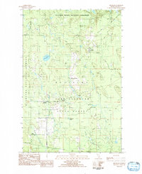
1983 Map of Melstrand
USGS Topo · Published 1984About this map
Pictured Rocks National Lakeshore and the Hiawatha National Forest converge in this northern Michigan landscape, where the footprint of the logging and transit industry remains visible. Multiple sections of Old RR Grade cut through the timberlands, marking former paths of resource extraction that once connected small hubs like Melstrand and Williams Crossing. The map reveals a transition from managed forest to protected shoreline, with the northern boundary defined by the Lakeshore Bdy.
Find a feature on this map
23 named features on this map. Tap any name to fly to it.
Don’t see what you’re looking for? This feature index may not catch every label — zoom into the map to look around manually.
Map Details
Editions of this 1983 Melstrand Map
This is the sole edition of this map. No revisions or reprints were ever made.
Other maps of this area

1931 · Shingleton SW
USGS Topo · 1:31,680

1931 · Shingleton NE
USGS Topo · 1:31,680

1931 · Shingleton SE
USGS Topo · 1:31,680

1931 · Munising SE
USGS Topo · 1:31,680

1958 · Munising
USGS Topo · 1:62,500

1958 · Wood Island
USGS Topo · 1:62,500

1958 · Shingleton
USGS Topo · 1:62,500

1958 · Grand Portal Point
USGS Topo · 1:62,500

1958 · Marquette
USGS Topo · 1:250,000

1960 · Marquette
USGS Topo · 1:250,000