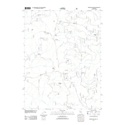
2012 Map of Mendocino Pass
USGS Topo · Published 2012About this map
Anthony Peak and its namesake lookout tower command the high ground of this Mendocino County landscape, marking a significant transition point in the local geography. The area is defined by a series of named high-elevation sites such as Government Flat, Board Ridge, and Espee Ridge, which separate various drainage systems including the Black Butte River and Grindstone Creek. This 2012 survey illustrates the importance of high-altitude access and resource management, with a dense network of Forest Service routes like Forest Route M4 and Forest Route 22N16 connecting remote outposts and recreational sites. Several historically significant family-named locations are documented here, including Hardy Place, Bredehoft Place, and Bollinger Place. These named settlements, alongside seasonal camps like Smith Camp and established grounds like Sugar Spring Campground, reflect a legacy of land use tied to the high ridges and seasonal springs of the coastal range.
Find a feature on this map
62 named features on this map. Tap any name to fly to it.
Don’t see what you’re looking for? This feature index may not catch every label — zoom into the map to look around manually.
Map Details
Editions of this 2012 Mendocino Pass Map
This is the sole edition of this map. No revisions or reprints were ever made.
Other maps of this area

1926 · Covelo
USGS Topo · 1:62,500

1929 · Eden Valley
USGS Topo · 1:62,500

1952 · Hull Mountain
USGS Topo · 1:62,500

1952 · Eden Valley
USGS Topo · 1:62,500

1952 · Covelo
USGS Topo · 1:62,500

1952 · Anthony Peak
USGS Topo · 1:62,500

1957 · Ukiah
USGS Topo · 1:250,000

1960 · Ukiah
USGS Topo · 1:250,000
1966 · Leech Lake Mountain
USGS Topo · 1:24,000

1967 · Plaskett Ridge
USGS Topo · 1:24,000