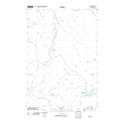
2010 Map of Meno
USGS Topo · Published 2010About this map
The Saint Regis River meanders through this remote portion of the Adirondack Park, where isolated settlements like Madawaska and Gile mark the early 21st-century landscape. The topography is defined by significant elevations, including Azure Mountain in the southwest and Jennings Mountain to the east. Historically, this area relied on water and wood, evidenced by the network of brooks and ponds such as Madawaska Pond and Benz Pond. The map shows a transition from earlier industrial or transit-oriented uses toward conservation, with named peaks like Porcupine Hill and Bearcove Hill overlooking a terrain largely shaped by the flow of the Quebec Brook and Trout Brook. Smaller hamlets like Spring Cove and Meno are positioned near these waterways, connected by rural routes such as Blue Mountain Rd.
Find a feature on this map
43 named features on this map. Tap any name to fly to it.
Don’t see what you’re looking for? This feature index may not catch every label — zoom into the map to look around manually.
Map Details
Editions of this 2010 Meno Map
This is the sole edition of this map. No revisions or reprints were ever made.
Other maps of this area

1905 · Saint Regis
USGS Topo · 1:62,500

1919 · Nicholville
USGS Topo · 1:62,500

1920 · Childwold
USGS Topo · 1:62,500

1921 · Childwold
USGS Topo · 1:48,000

1921 · Nicholville
USGS Topo · 1:62,500

1921 · Santa Clara
USGS Topo · 1:62,500

1922 · Childwold
USGS Topo · 1:62,500

1923 · Santa Clara
USGS Topo · 1:62,500

1948 · Ogdensburg
USGS Topo · 1:250,000

1951 · Ogdensburg
USGS Topo · 1:250,000