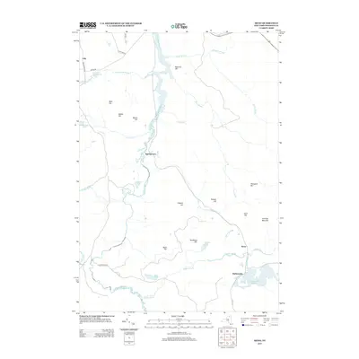
2013 Map of Meno
USGS Topo · Published 2013About this map
The Saint Regis River and Quebec Brook define the water-rich landscape of this Franklin County quadrangle, where small settlements like Meno and Madawaska anchor the southeastern corner. The terrain is characterized by numerous named peaks, including Jennings Mountain and Bearcove Hill, interspersed with isolated water bodies such as Benz Pond and Madawaska Pond. The network of backroads, including the suggestively named Gold Mine Rd, Dexter Rd, and Blue Mountain Rd, provides access to these timbered highlands. At Spring Cove, the river takes a prominent bend, marking a historical point of interest along the waterway. The map captures a transition between the elevated summits of Porcupine Hill and Hurd Hill and the complex drainage systems of Beaver Brook and Trout Brook that feed into the larger river basins.
Find a feature on this map
38 named features on this map. Tap any name to fly to it.
Don’t see what you’re looking for? This feature index may not catch every label — zoom into the map to look around manually.
Map Details
Editions of this 2013 Meno Map
This is the sole edition of this map. No revisions or reprints were ever made.
Other maps of this area

1905 · Saint Regis
USGS Topo · 1:62,500

1919 · Nicholville
USGS Topo · 1:62,500

1920 · Childwold
USGS Topo · 1:62,500

1921 · Childwold
USGS Topo · 1:48,000

1921 · Nicholville
USGS Topo · 1:62,500

1921 · Santa Clara
USGS Topo · 1:62,500

1922 · Childwold
USGS Topo · 1:62,500

1923 · Santa Clara
USGS Topo · 1:62,500

1948 · Ogdensburg
USGS Topo · 1:250,000

1951 · Ogdensburg
USGS Topo · 1:250,000