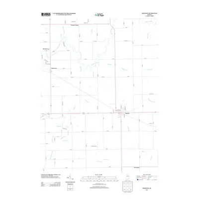
2013 Map of Mentone
USGS Topo · Published 2013About this map
Mentone serves as the primary hub in this agricultural landscape of northern Indiana, where the grid of county roads is punctuated by legacy farmsteads like Feldman Farms, Apple Farms, and East Farms. The Tippecanoe River meanders through the northwestern corner, passing the settlements of Tippecanoe and Old Tip Town. This area is defined by an intricate network of drainage systems essential to local farming, including named waterways such as Dorsey Ditch, William Baker Ditch, and Clarence Baker Ditch. To the south, the village of Sevastopol sits near the crossing of Yellow Creek, while Summit Chapel marks the northern boundary. The presence of Mentone Airport and several residential drives, such as Boyer Lake Dr and River Ridge Rd, highlights the continued modernization of this rural corridor between Marshall and Kosciusko counties.
Find a feature on this map
84 named features on this map. Tap any name to fly to it.
Don’t see what you’re looking for? This feature index may not catch every label — zoom into the map to look around manually.
Map Details
Editions of this 2013 Mentone Map
This is the sole edition of this map. No revisions or reprints were ever made.
Other maps of this area

1953 · Fort Wayne
USGS Topo · 1:250,000

1953 · Chicago
USGS Topo · 1:250,000

1956 · Fort Wayne
USGS Topo · 1:250,000

1957 · Chicago
USGS Topo · 1:250,000

1957 · Inwood
USGS Topo · 1:24,000

1958 · Bourbon
USGS Topo · 1:24,000

1959 · Atwood
USGS Topo · 1:24,000

1959 · Mentone
USGS Topo · 1:24,000

1961 · Silver Lake
USGS Topo · 1:24,000
1961 · Burket
USGS Topo · 1:24,000