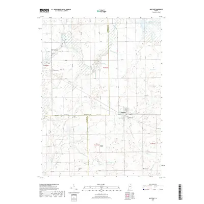
2019 Map of Mentone
USGS Topo · Published 2019About this map
Mentone serves as the primary hub for this rural stretch of northern Indiana, where the borders of Marshall, Kosciusko, and Fulton counties meet. The landscape is defined by an intricate network of agricultural drainage systems including the William Baker Ditch, Welch Ditch, and Harsh Ditch, reflecting the region's managed wetlands and high-output farming. These artificial watercourses feed into the Tippecanoe River, which meanders through the northwest corner near Old Tip Town and the village of Tippecanoe.
Find a feature on this map
63 named features on this map. Tap any name to fly to it.
Don’t see what you’re looking for? This feature index may not catch every label — zoom into the map to look around manually.
Map Details
Editions of this 2019 Mentone Map
This is the sole edition of this map. No revisions or reprints were ever made.
Other maps of this area

1953 · Fort Wayne
USGS Topo · 1:250,000

1953 · Chicago
USGS Topo · 1:250,000

1956 · Fort Wayne
USGS Topo · 1:250,000

1957 · Chicago
USGS Topo · 1:250,000

1957 · Inwood
USGS Topo · 1:24,000

1958 · Bourbon
USGS Topo · 1:24,000

1959 · Atwood
USGS Topo · 1:24,000

1959 · Mentone
USGS Topo · 1:24,000

1961 · Silver Lake
USGS Topo · 1:24,000
1961 · Burket
USGS Topo · 1:24,000