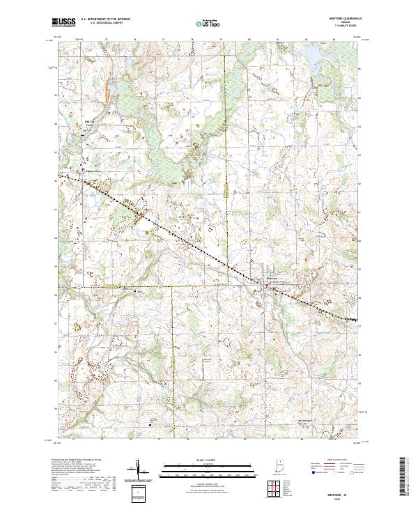
2022 Map of Mentone
USGS Topo · Published 2022About this map
Mentone serves as the primary hub in this northern Indiana landscape, where the borders of Marshall, Kosciusko, and Fulton counties converge. The local economy and drainage are defined by an intricate network of managed waterways, including Washam Ditch, Welch Ditch, and Moore Ditch, which feed into the meandering Tippecanoe River to the west. This river valley is home to the small settlements of Tippecanoe and the interestingly named Old Tip Town, the latter of which sits near the northern boundary. Genealogists will find several rural burial grounds documented, such as Tippecanoe Cem and Yellow Creek Cem, while Sycamore Memorial Park provides a dedicated green space near the southern edge of the survey. The presence of the Mentone Airport and the small hamlet of Sevastopol further illustrates the intersection of mid-century infrastructure and traditional farming communities.
Find a feature on this map
68 named features on this map. Tap any name to fly to it.
Don’t see what you’re looking for? This feature index may not catch every label — zoom into the map to look around manually.
Map Details
Editions of this 2022 Mentone Map
This is the sole edition of this map. No revisions or reprints were ever made.
Other maps of this area

1953 · Fort Wayne
USGS Topo · 1:250,000

1953 · Chicago
USGS Topo · 1:250,000

1956 · Fort Wayne
USGS Topo · 1:250,000

1957 · Chicago
USGS Topo · 1:250,000

1957 · Inwood
USGS Topo · 1:24,000

1958 · Bourbon
USGS Topo · 1:24,000

1959 · Atwood
USGS Topo · 1:24,000

1959 · Mentone
USGS Topo · 1:24,000

1961 · Silver Lake
USGS Topo · 1:24,000
1961 · Burket
USGS Topo · 1:24,000