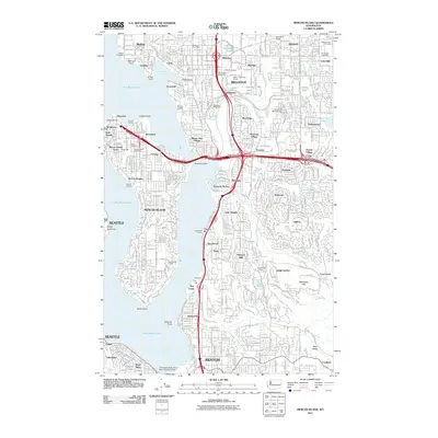
2011 Map of Mercer Island
USGS Topo · Published 2011About this map
Lake Washington defines the western edge of this 2011 survey, where the dense suburban development of King County meets the shorelines of Bellevue, Renton, and Newcastle. The landscape is a complex network of residential neighborhoods like Somerset and Newport Hills, separated by steep ravines and creeks such as Honey Dew Creek and Richards Creek. This era of the region is characterized by significant infrastructure, notably the Factoria Interchange and Eastgate Interchange, which anchor the commercial hubs of Factoria and Eastgate.
Find a feature on this map
82 named features on this map. Tap any name to fly to it.
Don’t see what you’re looking for? This feature index may not catch every label — zoom into the map to look around manually.
Map Details
Editions of this 2011 Mercer Island Map
This is the sole edition of this map. No revisions or reprints were ever made.
Other maps of this area

1894 · Seattle
USGS Topo · 1:62,500

1895 · Snohomish
USGS Topo · 1:125,000

1897 · Tacoma
USGS Topo · 1:125,000

1897 · Seattle
USGS Topo · 1:125,000

1900 · Tacoma
USGS Topo · 1:125,000

1908 · Seattle
USGS Topo · 1:62,500

1909 · Seattle Special
USGS Topo · 1:62,500

1949 · Maple Valley
USGS Topo · 1:24,000

1949 · Renton
USGS Topo · 1:24,000

1949 · Seattle North
USGS Topo · 1:24,000