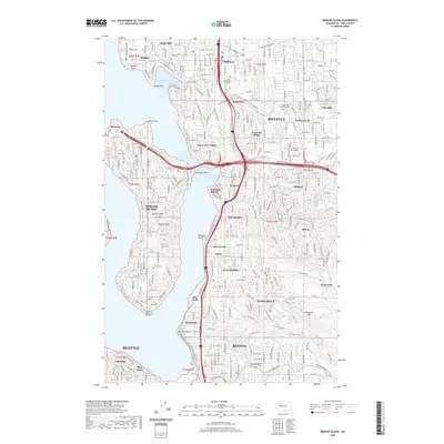
2020 Map of Mercer Island
USGS Topo · Published 2020About this map
Lake Washington dominates the western half of this 2020 landscape, surrounding the central landmass of Mercer Island and creating a complex shoreline of inlets like Meydenbauer Bay and points such as Groat Point. The transition from residential neighborhoods to more densely developed urban centers is evident in Bellevue, where Wilburton and Midlakes show the intricate street networks of the modern era. The presence of Bellevue College and the City University of Seattle highlights the area's role as a regional educational hub.
Find a feature on this map
74 named features on this map. Tap any name to fly to it.
Don’t see what you’re looking for? This feature index may not catch every label — zoom into the map to look around manually.
Map Details
Editions of this 2020 Mercer Island Map
This is the sole edition of this map. No revisions or reprints were ever made.
Other maps of this area

1894 · Seattle
USGS Topo · 1:62,500

1895 · Snohomish
USGS Topo · 1:125,000

1897 · Tacoma
USGS Topo · 1:125,000

1897 · Seattle
USGS Topo · 1:125,000

1900 · Tacoma
USGS Topo · 1:125,000

1908 · Seattle
USGS Topo · 1:62,500

1909 · Seattle Special
USGS Topo · 1:62,500

1949 · Maple Valley
USGS Topo · 1:24,000

1949 · Renton
USGS Topo · 1:24,000

1949 · Seattle North
USGS Topo · 1:24,000