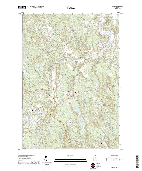
2024 Map of Mercer
USGS Topo · Published 2024About this map
Sandy River winds through the heart of the Somerset and Franklin county line, creating a landscape of fertile bottoms and river islands such as Bowden Island, Farrand Island, and Yeaton Island. The rural settlements of Mercer and Starks serve as anchors for a network of winding backroads and family-named landmarks. The area is exceptionally well-documented for genealogical research, with numerous small burial grounds including Hampshire Hill Cem, Elliot - Young Cem, and Ladd - Mercer Cem scattered across the uplands. Significant topographical features like Beech Hill and the smaller Little Beech Hill dominate the eastern portion of the quadrangle, which also features the Beech Hill Airport. The drainage patterns are defined by various tributaries including Bog Stream and Indian Stream, reflecting a classic Maine interior landscape where valley agriculture meets timbered hills.
Find a feature on this map
71 named features on this map. Tap any name to fly to it.
Don’t see what you’re looking for? This feature index may not catch every label — zoom into the map to look around manually.
Map Details
Editions of this 2024 Mercer Map
This is the sole edition of this map. No revisions or reprints were ever made.
Other maps of this area

1894 · Norridgewock
USGS Topo · 1:62,500

1898 · Norridgewock
USGS Topo · 1:62,500

1904 · Anson
USGS Topo · 1:62,500

1924 · Farmington
USGS Topo · 1:62,500

1930 · Kingfield
USGS Topo · 1:48,000

1932 · Kingfield
USGS Topo · 1:62,500

1943 · Norridgewock
USGS Topo · 1:62,500

1948 · Bangor
USGS Topo · 1:250,000

1950 · Lewiston
USGS Topo · 1:250,000

1955 · Anson
USGS Topo · 1:62,500