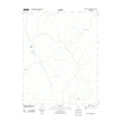
2012 Map of Mercey Hot Springs
USGS Topo · Published 2012About this map
Mercey Hot Springs anchors the western edge of this landscape, serving as a distinct focal point in a region defined by its drainage systems and sharp elevation changes. The hydrology of the area is dominated by the winding course of Little Panoche Cr and its major tributary, S Fork Little Panoche Cr, which carve through the terrain toward the lower elevations. The physical geography is marked by significant rises such as Panoche Mountain in the northeast and the distinctive Glaucophane Ridge to the west, suggesting a geology rich in metamorphic rock. Movement through this portion of Fresno County is facilitated by the Panoche Access Rd, which connects the high ground near the ridges to the sheltered expanses of Indian Valley in the southeast. This 2012 survey illustrates a sparsely populated but geographically complex section of the California Coast Ranges.
Find a feature on this map
7 named features on this map. Tap any name to fly to it.
Don’t see what you’re looking for? This feature index may not catch every label — zoom into the map to look around manually.
Map Details
Editions of this 2012 Mercey Hot Springs Map
This is the sole edition of this map. No revisions or reprints were ever made.
Other maps of this area

1913 · Panoche
USGS Topo · 1:125,000

1921 · Laguna Seca Ranch
USGS Topo · 1:31,680

1921 · Tierra Loma School
USGS Topo · 1:31,680

1923 · Laguna Seca Ranch
USGS Topo · 1:31,680

1923 · Tierra Loma School
USGS Topo · 1:31,680

1923 · Little Panoche
USGS Topo · 1:31,680

1943 · Ortigalita Peak
USGS Topo · 1:62,500

1944 · Panoche Valley
USGS Topo · 1:62,500

1948 · Santa Cruz
USGS Topo · 1:250,000

1955 · Santa Cruz
USGS Topo · 1:250,000