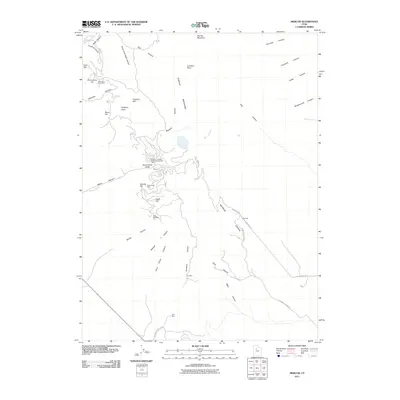
2011 Map of Mercur
USGS Topo · Published 2011About this map
The mining history of the Oquirrh Mountains is etched into the landscape of this survey, centered on the historic settlement of Mercur. This high-altitude district is defined by deep canyons and gulches that once served as the backbone of local industry. Distinctive peaks such as Lewiston Peak and Flat Top Mountain overlook a complex network of industrial sites, including the Sacramento Mine, Geyser-Marion Mine, and the Golden Gate Mine. To the southeast, the settlements of Manning and Sunshine mark the lower reaches of the district, connected by historic thoroughfares like Manning Canyon Rd and Sunshine Canyon Rd. The map documents a rugged interior of named landforms such as Sacramento Gulch, Eagle Hill, and Silveropolis Hill, reflecting a century of mineral extraction and the movement of workers between the mountain camps and the valley floors. Water features like Mercur Creek and Ophir Creek provide the only breaks in the arid mountain terrain.
Find a feature on this map
45 named features on this map. Tap any name to fly to it.
Don’t see what you’re looking for? This feature index may not catch every label — zoom into the map to look around manually.
Map Details
Editions of this 2011 Mercur Map
This is the sole edition of this map. No revisions or reprints were ever made.
Other maps of this area

1885 · Tooele Valley
USGS Topo · 1:250,000

1915 · Fairfield
USGS Topo · 1:62,500

1917 · Fairfield
USGS Topo · 1:62,500

1918 · Stockton
USGS Topo · 1:62,500

1947 · Fivemile Pass
USGS Topo · 1:62,500

1947 · Goshen Pass
USGS Topo · 1:24,000

1949 · Fivemile Pass
USGS Topo · 1:24,000

1949 · Goshen Pass
USGS Topo · 1:24,000

1953 · Tooele
USGS Topo · 1:250,000
1954 · Tickville Spring
USGS Topo · 1:24,000