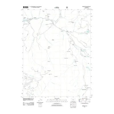
2011 Map of Meredith
USGS Topo · Published 2011About this map
The Fryingpan River drainage serves as the primary corridor for settlement and transit in this high-altitude landscape, where the small communities of Meredith, Thomasville, and Norrie line the valley floor. Mining legacy is a defining characteristic of the area, evidenced by the presence of the Meredith Mine, Wellington Mine, and Country Boy Mine tucked into the steep gulches of the surrounding mountains. These operations, alongside the Fryingpan Group Mine, highlight the historical extraction efforts that once drove local industry before the shift toward modern forest management and recreation.
Find a feature on this map
70 named features on this map. Tap any name to fly to it.
Don’t see what you’re looking for? This feature index may not catch every label — zoom into the map to look around manually.
Map Details
Editions of this 2011 Meredith Map
This is the sole edition of this map. No revisions or reprints were ever made.
Other maps of this area

1893 · Aspen
USGS Topo · 1:62,500

1895 · Aspen
USGS Topo · 1:62,500

1909 · Mount Jackson
USGS Topo · 1:125,000

1911 · Mount Jackson
USGS Topo · 1:125,000

1957 · Leadville
USGS Topo · 1:250,000

1959 · Leadville
USGS Topo · 1:250,000

1960 · Leadville
USGS Topo · 1:250,000
1960 · Thimble Rock
USGS Topo · 1:24,000

1960 · Aspen
USGS Topo · 1:24,000
1960 · Mount Champion
USGS Topo · 1:24,000