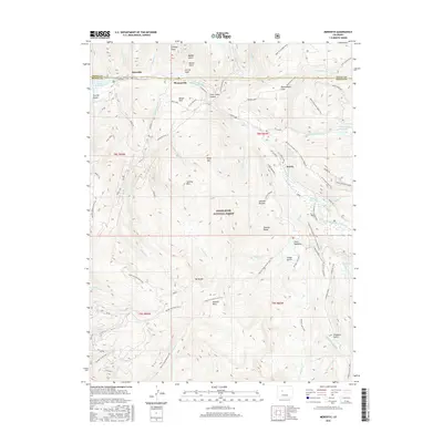
2016 Map of Meredith
USGS Topo · Published 2016About this map
The Fryingpan River corridor serves as the primary axis for human settlement and transport through this high-elevation landscape, where the small communities of Meredith, Thomasville, and Norrie are situated. These settlements are positioned along the river’s path as it flows toward the Ruedi Reservoir at the western edge of the quadrangle. The area is heavily defined by its inclusion within the White River National Forest, featuring a complex network of forest roads and trails such as the Norrie Powerline Trail and the Sawyer Lake Trail that penetrate the surrounding peaks. Significant landmarks include the heights of Mt Yeckel and the distinct geography of Lime Creek Canyon. Notable water management and recreational features like Chapman Reservoir and Sawyer Lake emphasize the importance of high-country hydrology and resource conservation in this portion of Pitkin County.
Find a feature on this map
62 named features on this map. Tap any name to fly to it.
Don’t see what you’re looking for? This feature index may not catch every label — zoom into the map to look around manually.
Map Details
Editions of this 2016 Meredith Map
This is the sole edition of this map. No revisions or reprints were ever made.
Other maps of this area

1893 · Aspen
USGS Topo · 1:62,500

1895 · Aspen
USGS Topo · 1:62,500

1909 · Mount Jackson
USGS Topo · 1:125,000

1911 · Mount Jackson
USGS Topo · 1:125,000

1957 · Leadville
USGS Topo · 1:250,000

1959 · Leadville
USGS Topo · 1:250,000

1960 · Leadville
USGS Topo · 1:250,000
1960 · Thimble Rock
USGS Topo · 1:24,000

1960 · Aspen
USGS Topo · 1:24,000
1960 · Mount Champion
USGS Topo · 1:24,000