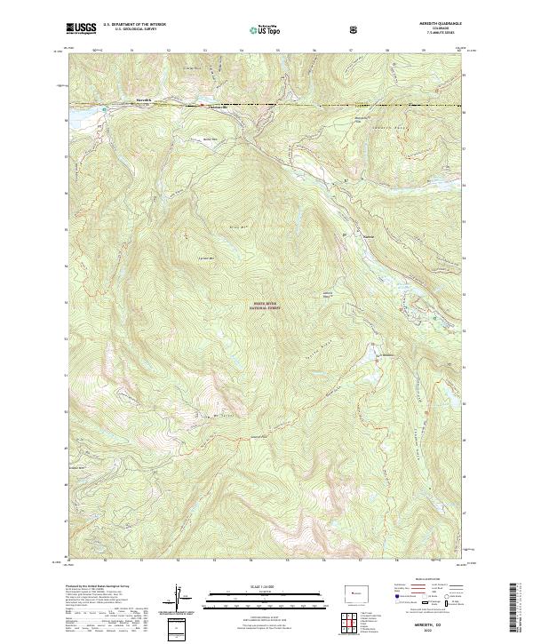
2022 Map of Meredith
USGS Topo · Published 2022About this map
The Fryingpan River corridor anchors this high-elevation area of the White River National Forest, where the small settlements of Meredith and Thomasville sit along the riverbanks near the northern edge of the map. This landscape is a complex network of forest access and utility infrastructure, featuring the Norrie Powerline Trl and the Sawyer Cr Conduit near Norrie. The terrain is characterized by steep ridges and glacial features, from the heights of Mt Yeckel and Cyclone Mtn down to the basins of Chapman Reservoir and Himmelland Reservoir. Historical travel patterns are evident in the numerous pack trails and timber roads, such as the Burnt Mtn Timber Road and the Aspen-Norrie Trl, which connect remote clearings like Sawmill Park and Lamont Pasture to the river valley floor.
Find a feature on this map
80 named features on this map. Tap any name to fly to it.
Don’t see what you’re looking for? This feature index may not catch every label — zoom into the map to look around manually.
Map Details
Editions of this 2022 Meredith Map
This is the sole edition of this map. No revisions or reprints were ever made.
Other maps of this area

1893 · Aspen
USGS Topo · 1:62,500

1895 · Aspen
USGS Topo · 1:62,500

1909 · Mount Jackson
USGS Topo · 1:125,000

1911 · Mount Jackson
USGS Topo · 1:125,000

1957 · Leadville
USGS Topo · 1:250,000

1959 · Leadville
USGS Topo · 1:250,000

1960 · Leadville
USGS Topo · 1:250,000
1960 · Thimble Rock
USGS Topo · 1:24,000

1960 · Aspen
USGS Topo · 1:24,000
1960 · Mount Champion
USGS Topo · 1:24,000