
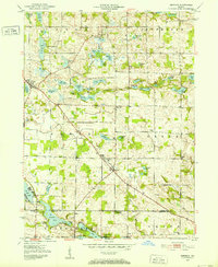
1951 Map of Merriam
USGS Topo · Published 1953About this map
Glacial topography defines this corner of Northeast Indiana, where the Noble Co Whitley Co line divides a landscape saturated with small kettle lakes and wetlands. The settlement of Merriam serves as a central point along the primary thoroughfare, surrounded by rural institutions including the Merriam Chapel and the Sanford Cem. To the northwest, the village of Wolf Lake sits near a dense cluster of water bodies such as Lower Long Lake and Upper Long Lake, illustrating the post-glacial drainage patterns typical of the region. The map captures a mid-century agricultural community still reliant on local landmarks like the Green Sch and several country churches, including the Blue River German Ch and Pilgrim Ch. Of particular interest to local historians is the Landing Strip located near Burr Oak, reflecting the early integration of private aviation into the rural Midwestern landscape.
Find a feature on this map
66 named features on this map. Tap any name to fly to it.
Don’t see what you’re looking for? This feature index may not catch every label — zoom into the map to look around manually.
Map Details
Editions of this 1951 Merriam Map
2 editions found
Other maps of this area

1951 · Ormas
USGS Topo · 1:24,000

1953 · Fort Wayne
USGS Topo · 1:250,000

1955 · Columbia City
USGS Topo · 1:24,000

1955 · Ege
USGS Topo · 1:24,000

1955 · Kendallville
USGS Topo · 1:24,000

1956 · Fort Wayne
USGS Topo · 1:250,000

1956 · Ligonier
USGS Topo · 1:24,000

1956 · Lorane
USGS Topo · 1:24,000

1956 · Albion
USGS Topo · 1:24,000

1957 · Churubusco
USGS Topo · 1:24,000