
2019 Map of Merritt
USGS Topo · Published 2019About this map
Merritt serves as a central point in this rural landscape within Missaukee County, situated where E Houghton Lake Rd and N Merritt Rd meet. The area is defined by the winding course of the West Branch Muskegon River and its larger counterpart, the Muskegon River, which cut through a terrain heavily dominated by wetlands and low-lying drainage basins. To the north, the small settlement of Star City is anchored by the Star City Cem, while the southern reaches feature the community of Butterfield and the Butterfield Cem near the banks of Butterfield Cr. The map reveals a strict township-and-range grid system, with roads like E Sanborn Rd and E Beeler Rd providing access to the isolated homesteads and timberlands that characterize this portion of Northern Michigan.
Find a feature on this map
41 named features on this map. Tap any name to fly to it.
Don’t see what you’re looking for? This feature index may not catch every label — zoom into the map to look around manually.
Map Details
Editions of this 2019 Merritt Map
This is the sole edition of this map. No revisions or reprints were ever made.
Other maps of this area

1954 · Traverse City
USGS Topo · 1:250,000

1956 · Houghton Lake
USGS Topo · 1:62,500

1956 · Lake City
USGS Topo · 1:62,500

1957 · Harrison
USGS Topo · 1:62,500

1957 · Marion
USGS Topo · 1:62,500

1958 · Traverse City
USGS Topo · 1:250,000

1983 · Cadillac
USGS Topo · 1:100,000
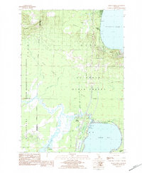
1983 · Meads Landing
USGS Topo · 1:25,000

1983 · Moddersville
USGS Topo · 1:25,000

1983 · Stittsville
USGS Topo · 1:24,000