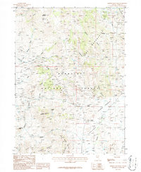
1986 Map of Merritt Mountain
USGS Topo · Published 1987About this map
Merritt Mountain anchors this rugged section of the Humboldt National Forest in northern Nevada, where high-elevation peaks and deeply incised canyons define the drainage patterns of the Great Basin. This mid-1980s provisional survey documents an landscape of resource extraction and transit, evidenced by the historic California Trail crossing the western foothills and numerous prospects scattered through the drainage of Big Creek. The map provides a detailed view of the water sources critical to this arid region, including Rough Mountain Springs, Jenkins Spring, and Archies Spring. A Telephone Line cuts through the Mahoganies and across Vincenti Canyon, tracing a modern path through terrain otherwise marked by traditional landmarks like Point of Rocks and the Horse Range. The topography reveals a transition from the prominent heights of Sunflower Mountain down to the high-desert expanse of Meadow Flat.
Find a feature on this map
37 named features on this map. Tap any name to fly to it.
Don’t see what you’re looking for? This feature index may not catch every label — zoom into the map to look around manually.
Map Details
Editions of this 1986 Merritt Mountain Map
This is the sole edition of this map. No revisions or reprints were ever made.
Other maps of this area

1935 · Charleston
USGS Topo · 1:48,000

1936 · Mountain City
USGS Topo · 1:62,500

1936 · Rowland
USGS Topo · 1:48,000

1940 · Rowland
USGS Topo · 1:62,500

1940 · Mountain City
USGS Topo · 1:62,500

1942 · Mt. Velma
USGS Topo · 1:62,500

1955 · Wells
USGS Topo · 1:250,000

1956 · Wild Horse
USGS Topo · 1:62,500

1958 · Wells
USGS Topo · 1:250,000

1961 · Wells
USGS Topo · 1:250,000